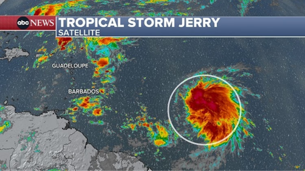
(NEW YORK) — A new tropical storm has formed in the Atlantic Ocean, but it will likely follow the pattern of other storms that have stayed mostly out to sea, forecasts show.
Tropical Storm Jerry formed in the central Atlantic late Tuesday morning and is expected to gradually strengthen as it moves west-northeast over the next few days, according to the National Hurricane Center.
The system, currently located about 1,300 miles east-southeast of the northern Leeward Islands, has maximum sustained winds of 45 mph and is moving quickly to the west at 24 mph.
The NHC has warned that Tropical Storm Watches may be required in the northern Leeward Islands by late Tuesday, but the system is not predicted to impact the continental U.S.
The overall weather pattern in place favors storms curving north up across the middle of the Atlantic Ocean and away from the U.S.
Jerry, the 10th named storm of the season, is forecast to make that turn to the north on Friday.
Several other storms this season, including Hurricanes Erin, Gabrielle and Humberto, stayed in the Atlantic Ocean without making landfall.
By the end of the upcoming weekend, Jerry could track close enough to Bermuda to bring some impacts. But it is too early to make any specific predictions for possible impacts.
It will all depend on the exact track and how the storm evolves over the next few days.
The Atlantic hurricane season runs through Nov. 30.
Copyright © 2025, ABC Audio. All rights reserved.
- Video of Clintons’ depositions in House Epstein probe is released - March 2, 2026
- Your Daily Briefing – March 2, 2026 - March 2, 2026
- Department of Homeland Security warns of potential attacks amid Iran operation - March 2, 2026


